
| Using SkylineGlobe 2D Web Application, users can navigate, search, and edit customized 2D maps on different platforms including tablets and smartphones. With no plug-in or installation and support for most operating systems and browsers, your users can access the information they need whenever and wherever they are. The SkylineGlobe 2D Application is available as either an independent web application or as an integrated component of the SkylineGlobe Web Package. | 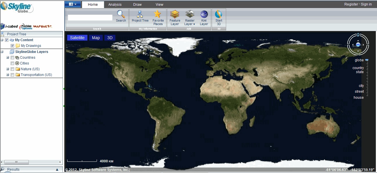 |
Navigate
Navigate freely using mouse controls or the virtual joystick, or search for a particular location. Favorite locations can be saved to your Favorite Places for easy future reference.
Annotate your maps
Create custom 2D maps by adding and editing raster and feature layers from WMS and WFS services, KML layers and basic drawings (points, lines, polygons). Your customized 2D maps can be easily integrated in the SkylineGlobe 3D application or viewed in the standalone 2D application.
View your data as you need
Map buttons enable you to switch between a map view, satellite view and 3D view of your data without moving off the map. Toggle display of overlay data layers and drawing objects so you can view precisely the data you need.
Measure distance and area
Measure any route by plotting its points or find the area of any polygon you draw. A scale bar helps orient you, showing the ratio of a distance in the 3D virtual World to the corresponding distance in the actual world.