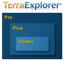
The TerraExplorer family of applications allows you to view, analyze and edit customized, virtual 3D landscapes
TerraExplorer is a powerful, easy-to-use tool for exploring, editing, analyzing, annotating and publishing photo-realistic interactive 3D environments. With this exciting, interactive application, users can overlay unique or exclusive information onto a 3D map, to highlight specific features of an area, and show function, relation and proximity along with a distinct view of the area. View
All the products in the TerraExplorer family are built utilizing the same technology.
|
Users can navigate through high resolution 3D world environments created by fusing aerial and satellite photography, terrain elevation data and other 2D and 3D information layers. Basic editing capabilities are available as well as advanced terrain analysis tools.
When embedded in a SkylineGlobe web package, the standard TerraExplorer Viewer serves as a SkylineGlobe viewer, providing advanced API capabilities. |
 |
Adds publishing capability, feature layer editing and querying, advanced objects and drawing tools, as well as a set of tools for professional usage.

