
TerraGate suite is a family of tools designed to support the client-server data delivery requirements of Skyline's 3D technology.
This powerful network feature and terrain server technology efficiently streams massive amounts of 3D geographic and feature data to thousands of concurrent users, giving each user uninterrupted viewing.
|
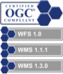
TerraGate v4.5.1 suite is compliant with OpenGIS Implementation Specifications for:
TerraGate v6.0 suite is compliant with OpenGIS Implementation Specifications for:
TerraGate suite supports OpenGIS Implementation Specifications for:
|
 |
Give your users a smooth seamless viewing experience
The Terrain Service works seamlessly across variable bandwidths on the Internet and is not affected by latency or breaks in connectivity. Once users have received the initial scene in low-resolution, they can begin accessing the 3D environment without waiting for entire frames of data to display.
Make massive archives of data accessible for 3D visualization in minutes
You can save time and resources by skipping the 3D terrain database (MPT) creation and streaming the native data to clients, using TerraGate DirectConnect. Once an updated image or elevation source is available, it can be loaded in a TerraBuilder project and be immediately available for clients to work with over the network.
Manage your data sources and layers easily and efficiently
Control and monitor server status, streaming layers and data sources and view performance and statistics from an easy-to use interface.
Deliver map and image data to all OGC-compliant applications
You can share data with any application that reads the standard OGC WFS and WMS protocols.
Easily access, manage and organize your remote raster, feature, and 3DML layers by connecting to the TerraCatalog database
TerraGate provides web interface to TerraCatalog, a catalog database that stores, organizes and manages connections to raster, feature, and 3DML layers. This enables remote users to easily query the catalog for the specific published layer required for a TerraBuilder or TerraExplorer project. The raster, feature, and 3DML data are then served to the client by the TerraGate service responsible for their data type.
Dramatically enhance your users' experience
You can give your users the ability to dynamically add elements to the 3D world and generate specific targeted flying experiences with TerraGate Internet License Service.
Enable your users to collaborate and share 3D experiences with other users
TerraGate Collaboration Service provides hosting services for collaboration sessions between TerraExplorer users. All participants can fly-through and study a 3D environment together, and make additions or changes to the 3D environment that will be seen by their partners.