
|
TerraExplorer Pro includes all the real-time 3D terrain viewing capabilities found in the TerraExplorer Viewer, as well as all the tools required for editing, analyzing, and annotating photo-realistic interactive 3D environments.
TerraExplorer Pro is an essential tool for content providers wishing to publish their unique local information over intranets or the Internet. It provides easy editing, annotation and publishing of photo-realistic, interactive, 3D visualizations. |
 |
![]() TerraExplorer Pro v6.6.1 Data Sheet
TerraExplorer Pro v6.6.1 Data Sheet
Load geo-referenced, satellite or aerial images and geo-referenced elevation raster
With TerraExplorer Pro, imagery and elevation layers of unlimited size and resolution in a wide range of formats, and from various supported GIS servers can be overlaid on the terrain. Automatic morphing is activated to create a smooth, seamless transition between the terrain imagery and the imagery layers. Layers that use a different coordinate system than the project’s are reprojected so that they can be correctly placed on the terrain. Basic editing of the imported raster layers, including repositioning and clipping, can be performed within TerraExplorer itself.
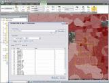
Load feature layers representing geographic data using points, lines, and polygons.
TerraExplorer Pro can load the entire content of the feature layer or stream the data directly from a server or local files so that you do not have to wait for the entire layer to load. When a feature layer is loaded, you are always connected to the data source (local or remote), so you can easily get the latest source updates by refreshing the layer.
The appearance and behaviors of all the geographic features contained within the layer can be set in the property sheet. For an imported feature layer with a set of attributes containing object level data, advanced layer information can be displayed in the 3D Window.
Spatial queries can be performed based on a selected or drawn geometry. Using the Attribute Table Tool, you can search and filter the data in a layer based on feature attributes. You can then display only the filtered data on the map or create a new layer that includes only this data. Available spatial operations include merging features into a single feature, creating a multipart feature, clipping one polygon from another, and exploding a multi-part feature into its individual component features.
Load fully textured, stream-optimized urban models (3DML)
The new 3D Mesh Layer (3DML) technology supported by TerraExplorer allows users to view and query high resolution textured 3D mesh models (3DML) created in TerraBuilder CityBuilder. Combined in CityBuilder into tiles optimized for streaming, these models provide accelerated loading speed and lower memory consumption. In TerraExplorer, 3DML layers are integrated seamlessly into the terrain, and fully support spatial and attribute queries, as well as complex measurements and analysis operations.
TerraExplorer Pro also offers a set of powerful tools for creating 3DML data sets from point layers with individually referenced 3D models. This allows you to transform your current project in one easy step into a vibrant 3D visualization with high resolution, photo textured, and highly-optimized 3D models.
Easily add 2D, 3D, dynamic and terrain objects to your project
In addition to sets of 2D and 3D primitives and labels, TerraExplorer Pro features a set of ground and air vehicles the user can add to the project by manually placing route way points in the 3D View. 3D models can be added to the project by manually defining the geometry of the building rooftop and stretching it above the basic terrain, or by importing the rooftop geometry from external feature layers. TerraExplorer Pro also provides a set of objects that enable you to modify the terrain, by changing the elevation values, cutting holes in the terrain, or playing a video file on the terrain.
TerraExplorer Pro provides multiple, intuitive methods of editing and repositioning objects as required. Pipe lines, power lines, fences/walls, or other objects can easily be duplicated along a user defined path or inside a specified area.
Analyze your 3D environments
TerraExplorer Pro increases understanding and improves decision making with powerful analysis tools, including Terrain Area, Line of Sight, Viewshed, 3D Viewshed, Threat Dome, Shadow Analysis, Flood Analysis, and Volume Analysis. The tools offer extremely flexible measurement and display options so that you can easily calculate and visualize the information you need. TerraExplorer’s Imagery Comparison tool supports enhanced spatial and visual analysis, allowing you to carefully compare an imagery layer to the base terrain or two images of the same location.
Set the appearance of the environment in the 3D Window
Enhance the realism of your 3D environment by controlling settings such as horizon distance, fog color, and sun and moon display. Preset or custom sky textures and colors can be applied and animated cloud layers can be displayed over the entire terrain, with customized altitude, position, density, and movement settings. Reflection and movement effects can be displayed on all sea and ocean terrain.
A shadow effect can be displayed for an entire scene (including terrain and all 3D models, objects, and buildings) or only for selected objects allowing you to visualize the shadow effect of a particular object on surrounding buildings and terrain. The precise color of the shadow can be selected to more accurately simulate the actual lighting conditions.
Share geographical information with others through dynamic presentations
TerraExplorer provides a powerful tool for creating and sharing photo-realistic presentations of any 3D environment. In presentation mode, you can record your navigation through the 3D World, determining in each presentation step the precise view in the 3D Window - what layers, objects, and messages are displayed, what tools are opened, and the current date and time. Routes can be created in the way you find most efficient and intuitive using any of the flexible available options, including flying through the terrain recording an exact route, adding sequential location waypoints, and following a dynamic object. An easy to use editor enables you to set step timings and transitions and modify step sequence.
A movie in AVI format can be created from any presentation in your project. This movie can then be played using a standard AVI Viewer or any product that supports AVI format or multi frames format, or even displayed on a TV screen.
Easily access, manage and organize your raster, feature, and 3DML layers by connecting to the TerraCatalog database
TerraExplorer users can easily find the geographic data required for a project by querying TerraCatalog, a catalog database that stores, organizes and manages connections to all your data sources, located on a local disk, on the network, on Oracle or on an SQL Server.
In addition to loading catalog layers into a project, TerraExplorer Pro users can bind a project to the catalog. In this case, every layer or project loaded into a project and all modifications to the project are automatically updated to the catalog every time the project is saved.
Extend the reach of 3D GIS from the office to the field itself
Skyline’s TerraExplorer Android App, with touch screen navigation and mobile-optimized user interface, allows you to navigate freely through local and remote terrain databases and 3DML city layers, fly to favorite locations, search the SkylineGlobe address server and position the camera according to your GPS location.
TerraExplorer publishing option enables you to easily publish entire TerraExplorer projects or subsets for use on android devices.
Customize the application’s ribbon and tools
TerraExplorer’s advanced ribbon customization options allow integration of custom tools into the TerraExplorer ribbon. Developers can add, delete and reorder ribbon entries, as well as add a range of tool types ranging from floating tools to tools with no user interface and auto-start tools, to create a user interface tailored to their specific requirements.
A TerraExplorer mechanism simplifies the process of installing add-on tools. The tool can be easily zipped into a .TEZ zip file, and distributed to TerraExplorer users.