
| Featuring most of TerraExplorer Pro’s editing and analysis tools along with access to the comprehensive TerraExplorer API, TerraExplorer Plus is the ideal TerraExplorer version for GIS analysts and developers. | 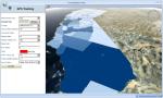 |
Design tools that utilize the full TerraExplorer Pro API
TerraExplorer Plus enables you to run tools and extensions that utilize the full TerraExplorer Pro API. TerraExplorer Plus can be used as a stand-alone application, or as integrated ActiveX components.
Add to the landscape various geographical information layers like state boundaries or freeway networks
With TerraExplorer, you can import feature layers from remote or local databases. Feature layer file types include: SkylineGlobe layer (.fly), Google Earth (.Kml/.Kmz) and ESRI Shape layer (.shp). Feature layer servers include: Web Feature Server (WFS), Skyline Feature Server (SFS), ESRI ArcSDE Server and Oracle Spatial Server. Layers are added to the Fly project as elements in the Information Window that can be toggled on and off.
Load geo-referenced, satellite or aerial images and geo-referenced elevation raster
With TerraExplorer Plus, imagery and elevation layers of unlimited size and resolution in a wide range of formats, and from various supported GIS servers can be overlaid on the terrain. Automatic morphing is activated to create a smooth, seamless transition between the terrain imagery and the imagery layers. Layers that use a different coordinate system than the project’s are reprojected so that they can be correctly placed on the terrain. Basic editing of the imported raster layers, including repositioning and clipping, can be performed within TerraExplorer itself.
Easily add 2D, 3D, dynamic and terrain objects to your project
TerraExplorer Plus users can overlay the terrain with 2D and 3D objects, as well as dynamic ground and air vehicles. Objects can easily be edited, duplicated, and repositioned as required.
Analyze your 3D environments
TerraExplorer Plus increases understanding and improves decision making with powerful analysis tools, including Terrain Area, Line of Sight, Viewshed, 3D Viewshed, Threat Dome, Shadow Analysis, Flood Analysis, and Volume Analysis. The tools offer extremely flexible measurement and display options so that you can easily calculate and visualize the information you need.
Set the appearance of the environment in the 3D Window
Enhance the realism of your 3D environment by controlling settings such as horizon distance, fog color, and sun and moon display. Preset or custom sky textures and colors can be applied and animated cloud layers can be displayed over the entire terrain, with customized altitude, position, density, and movement settings. Reflection and movement effects can be displayed on all sea and ocean terrain.
Share geographical information with others through dynamic presentations
TerraExplorer provides a powerful tool for creating and sharing photo-realistic presentations of any 3D environment. In presentation mode, you can record your navigation through the 3D World, determining in each presentation step the precise view in the 3D Window - what layers, objects, and messages are displayed, what tools are opened, and the current date and time. Routes can be created in the way you find most efficient and intuitive using any of the flexible available options, including flying through the terrain recording an exact route, adding sequential location waypoints, and following a dynamic object. An easy to use editor enables you to set step timings and transitions and modify step sequence.
A movie in AVI format can be created from any presentation in your project. This movie can then be played using a standard AVI Viewer or any product that supports AVI format or multi frames format, or even displayed on a TV screen.
Easily access, manage and organize your raster, feature, and 3DML layers by connecting to the TerraCatalog database
TerraExplorer users can easily find the geographic data required for a project by querying TerraCatalog, a catalog database that stores, organizes and manages connections to all your data sources, located on a local disk, on the network, on Oracle or on an SQL Server.