
SmartEye is an integrated digital monitoring system for construction projects. The term was first proposed by the Hong Kong Development Bureau, with the primary goal of performing remote supervision of high-risk construction works under all weather conditions. The versatile applications of SmartEye also include progress monitoring, quality inspection, site measurement, and safety management. The system typically comprises three categories of data acquisition: handheld LiDAR devices, fixed-position LiDAR scanners, and UAVs with automated docking stations for autonomous scanning operations. Data collected from these sources are consolidated and visualized through an online platform for clients, consultants, and contractors. Ambit is proud to participate in this innovative initiative and offer services that integrate automated data capture with a software platform to deliver continuous, high-precision point cloud data to potential clients.

Challenges in Traditional Site Monitoring
Currently, construction site monitoring and inspection rely primarily on manual processes carried out by site personnel. This approach presents several limitations. Inspections require staff to be physically present, and each inspector is typically limited to monitoring one site at a time. In addition, construction progress reporting may be subjective, as it largely depends on manual measurements and photographs captured at discrete time intervals.
Camera or sensor based monitoring solutions also have inherent constraints. These soultions often lack of accurate spatial data and are not capable of real-time monitoring. Traditional LiDAR based approaches, while offering positioning data, and high accuracy level, also face challenges. In many cases, they lack real-time capability and require manual intervention for data transfer, processing, and analysis.
System Components and Architecture (Fixed LiDAR Deployment)
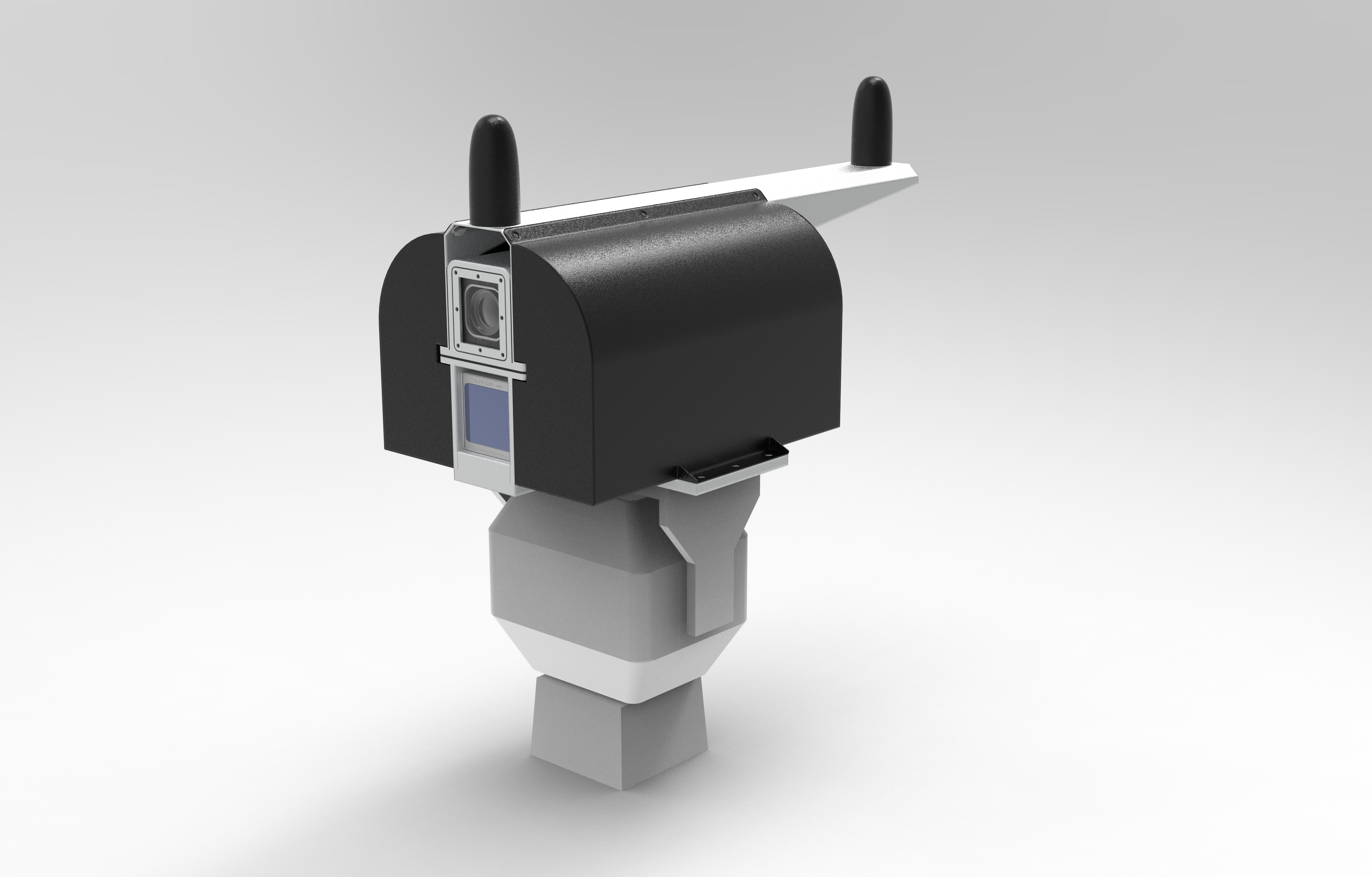
Ambit is committed to delivering high-quality products and services using components from trusted manufacturers. The SmartEye solution, with a focus on fixed-position LiDAR deployment, comprises several key components, including LiDAR sensors, IoT sensors, cameras, an edge computer, and a 5G communication network. A high-performance LiDAR sensor is installed at strategic fixed locations to continuously capture high resolution point cloud data of the construction site. The system is complemented by a colour camera for visual documentation, GNSS for precise positioning, and an inertial measurement unit (IMU) for orientation measurement. Additional IoT sensors can be integrated to monitor environmental and site conditions. A key feature of the system is the deployment of an on-site edge computer. The collected point cloud data are georeferenced and processed in near real time. The processed data are then transmitted to the SmartEye cloud platform via 5G networks.
SmartEye Online Platform
A free online platform is included as part of the SmartEye solution, allowing users to access and visualize project data in a centralized environment. The platform supports multi-user access, allowing management teams to monitor project progress simultaneously from different locations.
The platform displays key information such as point clouds, images, and timestamps of data collection, providing a comprehensive and up-to-date digital representation of the construction site.
Through integration with the SmartEye system, the platform supports a wide range of applications for remote project management, including:
In addition, the system supports customization based on client requirements, allowing integration of additional data sources such as temperature, air quality, and vibration levels around the installed hardware.
Fixed LiDAR Specification - Scanner
Maximum Detection: 450 m
Field of View: 70.4° *4.5°
Point Rate: ≥ 240,000 points/second
Distance Accuracy: ±2 cm
Fixed LiDAR Specification - Camera
Pixel Size: 3.45 μm × 3.45 μm
Resolution: 2448 × 2048
Max Frame Rate: 24.2 fps @2448 × 2048 Bayer RG 8
Working Temperature: -30 °C to 60 °C
Ambit Geospatial Solution and third parties collect personal information as specified in the privacy policy and use cookies or similar technologies for technical purposes and, with your consent, for experience, measurement and marketing (personalized ads) as specified in the cookie policy.
You can freely give, deny, or withdraw your consent at any time by accessing the preferences panel. Denying consent may make related features unavailable.
Use the “Accept” button to consent. Use the “Reject” button to continue without accepting.